Table of Contents
About Fellsmere Reservoir
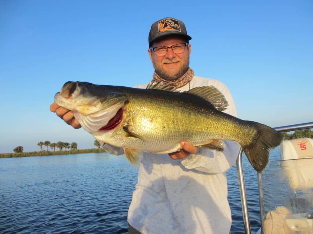
Chances are if you love to fish for Largemouth Bass, you have heard about the Fellsmere Reservoir (also known as Headwaters Lake) located in Central Florida. This 10,000-acre man-made impoundment is a bass fisherman’s DREAM!
If you anything like me, your probably searing for Fellsmere Reservoir maps, and want to learn more about navigation and access. Don’t worry I’ve got ya covered!
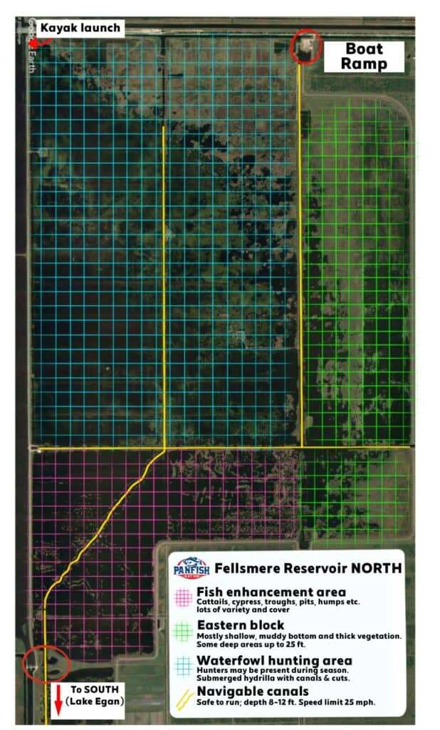
For this article, Ive split the lake into two main sections each with a description and what to expect. The YELLOW lines on the maps below indicate deep and safe areas to run. Most of these are dredged canals and present no major navgiation hazards.
Fellsmere Reservoir North
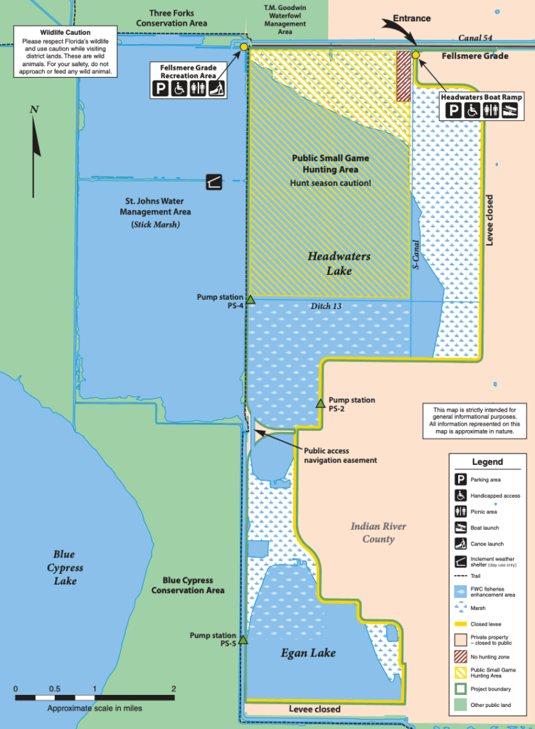
The northern portion of Fellsmere Reservoir is the largest, and easiest area to access because it is closest to the boat ramp and kayak launch. It primarily consists of the public waterfowl hunting area and the fish enhancement area. Access from the boat ramp is via the “S-Canal”.
From there you can take the “East/West” or “Ditch 13” Canal to the remainder of the unit. Hydrilla is prevalent throughout this area, but most of your emergent (standing) vegetation will be in the fish enhancement area and most of your submerged vegetation will be in the waterfowl hunting area.
This section has excellent fishing opportunities for bass, crappie and catfish. Do some exploring and your likely to find habitat that suits your fishing style!
Fellsmere Reservoir Map- NORTH
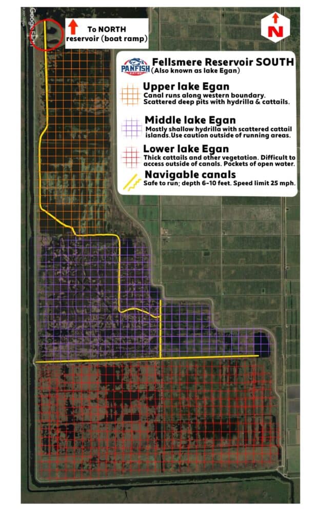
Fellsmere Reservoir South
The southern portion of the Fellsmere Reservoir primarily consists of “lake Egan’ which is not a separate lake, but just a name for the area south of the public access navigation easement.
This unit is much thicker than the northern portion. The further south you go in this unit, the thicker it gets! There are sparse pockets of open water and a few navigable canals and boat trails to get around.
If you want to really explore, find some hidden pockets of open water then head to this southern unit known as lake Egan. Its about a 6 mile run from the boat ramp, and weather changes happen quickly so plan accordingly!
Fellsmere Reservoir Map- SOUTH
Fellsmere Reservoir Water Depth Map
For a detailed map of the water depth at the reservoir, CLICK HERE (note this may take a few minutes to load). The average depth at Fellsmere Reservoir is 6 feet deep, with some areas reaching as deep as 30 feet! One of the most unique features about this fishery is that it has excellent bottom topography, which is rare in Florida!
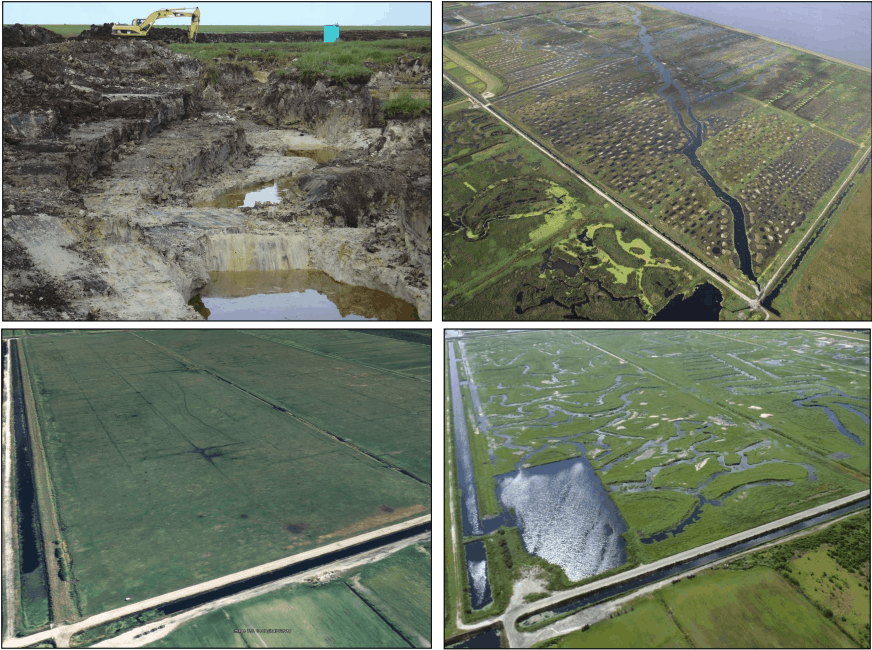
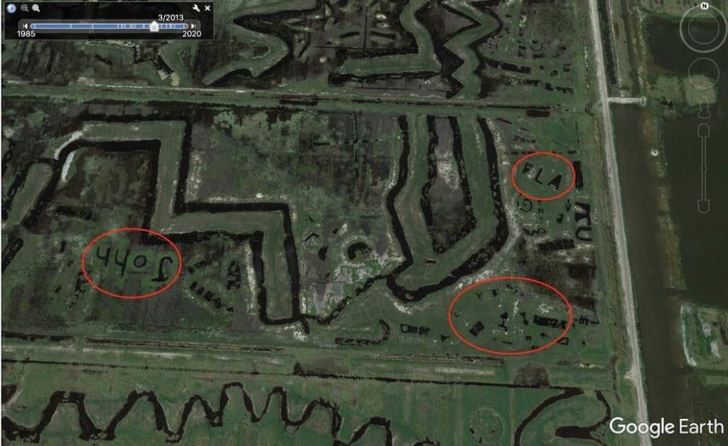
Before the lake was flooded, extensive dirt work shaped the bottom into hundreds of pits, troughs, channels, humps, islands and deep areas. If you look close on google earth, you can even see unique carvings and initials, dug right into the ground before flooding!
Fellsmere Reservoir General Map
Before Your Trip
If your planning a trip to fish the Fellsmere Reservoir, I highly recommend checking out my in-depth article that covers directions, access, boat ramps, history, biology, and of course fishing tips and tricks for this amazing place!
Like this post? Save it on Pinterest.